Category:Great Ness
Jump to navigation
Jump to search
English: Great Ness and Little Ness are parishes in Shropshire, England. The two parishes share a parish council.
village and civil parish in Shropshire, England, UK  | |||||
| Upload media | |||||
| Instance of | |||||
|---|---|---|---|---|---|
| Part of |
| ||||
| Location | Shropshire, West Midlands, England | ||||
 | |||||
Subcategories
This category has the following 2 subcategories, out of 2 total.
G
- St Andrew's, Great Ness (4 F)
K
- Kynaston's Cave (10 F)
Media in category "Great Ness"
The following 141 files are in this category, out of 141 total.
-
 140 year old graffiti - geograph.org.uk - 337981.jpg 640 × 480; 100 KB
-
 A5 - crossroads near Gildimoors - geograph.org.uk - 2248642.jpg 640 × 480; 69 KB
-

-
 A5 - footbridge near Nesscliffe - geograph.org.uk - 2248614.jpg 640 × 480; 53 KB
-
-
-
 A5 approaching Nesscliffe Services - geograph.org.uk - 3140917.jpg 640 × 430; 47 KB
-

-
 A5 approaching White Hall Roundabout - geograph.org.uk - 3140951.jpg 640 × 346; 32 KB
-
 A5 approaching Wolfshead roundabout - geograph.org.uk - 2248635.jpg 640 × 480; 54 KB
-
 A5 crossroads west of Low Bank - geograph.org.uk - 3711078.jpg 3,536 × 2,678; 1.71 MB
-
 A5 curving toward Wolshead - geograph.org.uk - 2248630.jpg 640 × 480; 51 KB
-
 A5 cutting near Nesscliffe - geograph.org.uk - 2248605.jpg 640 × 480; 44 KB
-
 A5 cutting with minor road crossing to Wilcott - geograph.org.uk - 4476962.jpg 1,600 × 1,066; 1.15 MB
-
 A5 east of Felton Butler - geograph.org.uk - 5249191.jpg 640 × 512; 60 KB
-
 A5 east of Kinton - geograph.org.uk - 2248620.jpg 640 × 480; 44 KB
-
 A5 footbridge west of Nesscliffe - geograph.org.uk - 3711076.jpg 3,648 × 2,736; 1.56 MB
-
 A5 near Nesscliffe - geograph.org.uk - 2248616.jpg 640 × 480; 53 KB
-
 A5 near Stone House - geograph.org.uk - 2248602.jpg 640 × 480; 46 KB
-
 A5 north of Felton Butler - geograph.org.uk - 5249192.jpg 640 × 513; 44 KB
-
 A5 north of Kinton - geograph.org.uk - 5249194.jpg 640 × 512; 44 KB
-
 A5 north of Wolshead roundabout - geograph.org.uk - 2248640.jpg 640 × 480; 59 KB
-
 A5 northbound near Coney Bank - geograph.org.uk - 5249195.jpg 640 × 480; 45 KB
-
 A5 overbridge crossing near Wilcott - geograph.org.uk - 5249193.jpg 640 × 513; 53 KB
-
 A5 overbridge south of Coney Bank - geograph.org.uk - 3711077.jpg 3,474 × 2,597; 1.02 MB
-
 A5 overbridge south of Nesscliffe - geograph.org.uk - 3711075.jpg 3,477 × 2,524; 1.16 MB
-
 A5 passes turning to Great Ness - geograph.org.uk - 3710899.jpg 3,648 × 2,736; 1.43 MB
-
 A5 passing Nesscliffe Services - geograph.org.uk - 3140922.jpg 640 × 430; 51 KB
-
 A5 south of White Hall - geograph.org.uk - 3711073.jpg 3,648 × 2,736; 1.28 MB
-
 A5 south of Wolfshead Roundabout - geograph.org.uk - 3140897.jpg 640 × 430; 54 KB
-
 A5 southbound - geograph.org.uk - 3140959.jpg 640 × 430; 41 KB
-
 Alderton Hall entrance - geograph.org.uk - 1507877.jpg 640 × 480; 104 KB
-
 America - geograph.org.uk - 464774.jpg 640 × 427; 73 KB
-
-
 Ash trees growing on the cliff - geograph.org.uk - 2191821.jpg 480 × 640; 115 KB
-
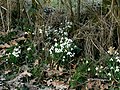 Banks of snowdrops - geograph.org.uk - 132411.jpg 640 × 480; 228 KB
-
 Beech tree clinging to the rock - geograph.org.uk - 2191918.jpg 640 × 480; 114 KB
-
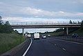 Bridge over the A5 - geograph.org.uk - 3140942.jpg 640 × 430; 42 KB
-
 Broomhill Farm - geograph.org.uk - 648307.jpg 640 × 314; 53 KB
-
 BT Communication Dishes - geograph.org.uk - 131825.jpg 640 × 480; 37 KB
-
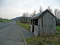 Bus shelter by the old A5 - geograph.org.uk - 648479.jpg 640 × 480; 83 KB
-
 Bus stop on B4396 at Wolfshead - geograph.org.uk - 4476973.jpg 1,600 × 1,200; 1.55 MB
-
-
-
 Exit to Knockin - geograph.org.uk - 2575103.jpg 480 × 640; 87 KB
-
 Fenced off area on Nesscliffe Hill - geograph.org.uk - 2192064.jpg 640 × 480; 109 KB
-
 Field, Felton Butler - geograph.org.uk - 4294907.jpg 800 × 533; 313 KB
-
 Fields, Nesscliffe - geograph.org.uk - 2210920.jpg 640 × 480; 227 KB
-
 Footbridge over A5 near Nesscliffe Hill - geograph.org.uk - 4476966.jpg 1,600 × 1,051; 1.11 MB
-
 Footbridge, A5 near Nesscliffe - geograph.org.uk - 3140929.jpg 640 × 430; 46 KB
-
 Former A5 - geograph.org.uk - 4295436.jpg 800 × 533; 310 KB
-
 Former sandstone quarry at Nesscliffe Hill - geograph.org.uk - 6326469.jpg 2,920 × 5,184; 5.72 MB
-
 Great Ness - geograph.org.uk - 4093301.jpg 640 × 480; 294 KB
-
 Great Ness turning from A5 - geograph.org.uk - 3698349.jpg 640 × 387; 158 KB
-
 Holyhead 100 - geograph.org.uk - 4776124.jpg 1,024 × 768; 274 KB
-
 Holyhead 97 - geograph.org.uk - 4776159.jpg 1,024 × 768; 308 KB
-
 Holyhead 98 - geograph.org.uk - 4930458.jpg 1,024 × 683; 204 KB
-
 Holyhead 99 - geograph.org.uk - 4776149.jpg 1,024 × 768; 344 KB
-
 Hopton - geograph.org.uk - 4093321.jpg 640 × 480; 282 KB
-
 Hopton Hill - geograph.org.uk - 5062198.jpg 1,024 × 683; 394 KB
-
 Horse gallops - geograph.org.uk - 6135971.jpg 5,184 × 3,888; 7.56 MB
-
 Junction of road, bridleway and footpath near Ruyton Moss - geograph.org.uk - 5233283.jpg 4,000 × 3,000; 4.68 MB
-
 Killed off field - geograph.org.uk - 4295418.jpg 800 × 533; 355 KB
-
 Killed off field near Nesscliffe - geograph.org.uk - 4295428.jpg 800 × 533; 346 KB
-
 Kynaston's Cave, Nesscliffe - geograph.org.uk - 4967418.jpg 1,200 × 1,600; 402 KB
-
 Lane, Great Ness - geograph.org.uk - 4093311.jpg 640 × 480; 297 KB
-
 Looking up the cliff - geograph.org.uk - 2191895.jpg 479 × 640; 110 KB
-
 Maddock's Farm Shop, Nesscliffe - geograph.org.uk - 6238571.jpg 4,000 × 3,000; 2.45 MB
-
 Manor Farm Felton Butler - geograph.org.uk - 1514173.jpg 640 × 480; 86 KB
-
 Milepost on the Holyhead road (A5) - geograph.org.uk - 664302.jpg 640 × 480; 75 KB
-
 Milestone near Kinton.jpg 768 × 1,024; 287 KB
-
 Milestone near Stone House.jpg 768 × 1,024; 365 KB
-
 Minor road bridge over A5 near Kinton - geograph.org.uk - 4476970.jpg 1,600 × 1,200; 1.22 MB
-
 Minor road off the A5 - geograph.org.uk - 3140879.jpg 640 × 430; 70 KB
-
 Minor road overbridge, A5 - geograph.org.uk - 3140905.jpg 640 × 430; 61 KB
-

-

-
 Nesscliffe bypass - geograph.org.uk - 132394.jpg 640 × 480; 155 KB
-
 Nesscliffe bypass on the A5 - geograph.org.uk - 4792467.jpg 640 × 456; 46 KB
-
 Nesscliffe Footbridge - geograph.org.uk - 5114028.jpg 1,600 × 1,064; 346 KB
-
 Nesscliffe Hill - geograph.org.uk - 2210923.jpg 640 × 480; 245 KB
-
 Nesscliffe Hill country park - geograph.org.uk - 2191758.jpg 480 × 640; 140 KB
-
 Nesscliffe Hill country park - geograph.org.uk - 2191875.jpg 640 × 480; 103 KB
-
 Nesscliffe Services landscaping - geograph.org.uk - 1866658.jpg 640 × 480; 55 KB
-
 Nesscliffe Services SE bound off A5 - geograph.org.uk - 1866630.jpg 640 × 480; 60 KB
-
 Nesscliffe Telephone Exchange - geograph.org.uk - 5967940.jpg 2,592 × 1,944; 1.36 MB
-
 Nesscliffe War Memorial - geograph.org.uk - 6238573.jpg 4,000 × 3,000; 2.47 MB
-

-
 Oilseed rape, Great Ness - geograph.org.uk - 4093182.jpg 640 × 480; 305 KB
-

-
 Old Toll House, Wolfshead (geograph 6115084).jpg 640 × 439; 195 KB
-
 Old village pump at Great Ness, Shropshire - geograph.org.uk - 6326403.jpg 5,184 × 2,920; 6.89 MB
-
 On the side of Nesscliffe Hill - geograph.org.uk - 2192051.jpg 640 × 480; 125 KB
-
 Ordnance Survey Flush Bracket 2765 - geograph.org.uk - 5233266.jpg 4,000 × 3,000; 5.14 MB
-
 Pink sky at Nesscliffe - geograph.org.uk - 2086157.jpg 640 × 486; 49 KB
-
 Pond on Nesscliffe Hill - geograph.org.uk - 2192073.jpg 640 × 480; 143 KB
-
 Population change in Great Ness from 1801 - 2001.png 551 × 315; 11 KB
-
 Population Structure of Great Ness 1881.png 603 × 340; 40 KB
-

-
 Road (the former A5) at The Prill - geograph.org.uk - 5233269.jpg 4,000 × 3,000; 2.87 MB
-
-
 Road near Lower Hopton - geograph.org.uk - 5233293.jpg 4,000 × 3,000; 4.02 MB
-

-
 Roundabout, A5 - geograph.org.uk - 3140884.jpg 640 × 369; 42 KB
-
 Seen better days - geograph.org.uk - 757896.jpg 640 × 480; 77 KB
-
 Severn Way in Shropshire - Pentre - geograph.org.uk - 3607227.jpg 3,072 × 2,304; 1.68 MB
-

-
 St Andrew's Church, Great Ness, Shropshire - geograph.org.uk - 6326397.jpg 5,184 × 2,920; 6.43 MB
-
 Startlewood - geograph.org.uk - 5062201.jpg 1,024 × 683; 347 KB
-
 Steps up to Kynaston's Cave at Nesscliffe - geograph.org.uk - 6326462.jpg 2,920 × 5,184; 6.2 MB
-
 The Church of St Andrew at Great Ness - geograph.org.uk - 5233257.jpg 4,000 × 3,000; 3.59 MB
-
 The Cottages, Hopton - geograph.org.uk - 2192079.jpg 640 × 480; 101 KB
-
 The Grove Inn, Pentre - geograph.org.uk - 650027.jpg 640 × 480; 58 KB
-
 The lower NW slopes of Nesscliffe Hill - geograph.org.uk - 2192054.jpg 640 × 480; 125 KB
-
 The Old Three Pigeons, Nesscliffe - geograph.org.uk - 6238572.jpg 3,842 × 2,539; 1.42 MB
-
 The quarried cliff face - geograph.org.uk - 2191922.jpg 480 × 640; 110 KB
-

-
 Training Area, Nesscliff Camp - geograph.org.uk - 939771.jpg 640 × 480; 72 KB
-
 View from Well Lane - geograph.org.uk - 2192101.jpg 640 × 479; 56 KB
-
-
 Visiting Units Mess, Nesscliff Camp - geograph.org.uk - 939763.jpg 640 × 321; 53 KB
-
 Walking up to Tea Tents - geograph.org.uk - 2192058.jpg 480 × 640; 129 KB
-
 Well Lane near Hopton - geograph.org.uk - 5233277.jpg 4,000 × 3,000; 3.78 MB
-
 Well Lane near Nesscliffe - geograph.org.uk - 5233272.jpg 4,000 × 3,000; 4.36 MB
-
 Wetland, Wilton Marsh - geograph.org.uk - 4295433.jpg 800 × 533; 325 KB
-
 Wilcot water tower - geograph.org.uk - 2192072.jpg 640 × 480; 84 KB
-
 Woodland in Spring - geograph.org.uk - 5757021.jpg 4,032 × 3,024; 6.23 MB
-
 Woodland, Hopton Hill - geograph.org.uk - 4093315.jpg 640 × 480; 346 KB
-
 Woods, Hopton Hill - geograph.org.uk - 4292694.jpg 800 × 600; 489 KB
-
 Disused army land - geograph.org.uk - 649663.jpg 640 × 480; 100 KB
-
 Felton Butler Manor Farm - geograph.org.uk - 648486.jpg 640 × 308; 49 KB
-

-
 Field of rape - geograph.org.uk - 648472.jpg 640 × 480; 119 KB
-
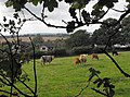
 Horses in pasture - geograph.org.uk - 649650.jpg 640 × 480; 78 KB
-
 Lane past Rodefern - geograph.org.uk - 664296.jpg 640 × 480; 99 KB
-
 Nesscliffe bypass - geograph.org.uk - 132385.jpg 640 × 480; 156 KB
-
 Nesscliffe Hill Country Park - geograph.org.uk - 1140.jpg 640 × 480; 75 KB
-
 Safe cycling along the A5 - geograph.org.uk - 664307.jpg 640 × 480; 51 KB
-
 St. Helena on Mill Lane - geograph.org.uk - 540847.jpg 640 × 480; 110 KB
-
 View from the top of Nesscliffe Hill - geograph.org.uk - 337989.jpg 640 × 288; 50 KB
-
 Woodland - geograph.org.uk - 132376.jpg 640 × 480; 224 KB


_-_geograph.org.uk_-_664302.jpg)


.jpg)


_at_the_entrance_to_Oswestry_Caravan_and_Camping_site_-_geograph.org.uk_-_5233303.jpg)
_at_The_Prill_-_geograph.org.uk_-_5233269.jpg)


